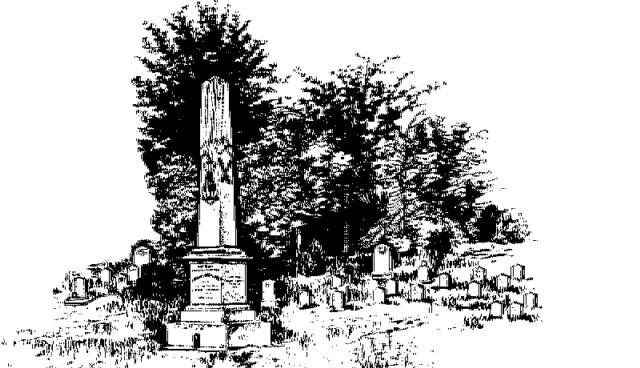
"They Sleep Beneath the Mockingbird",
A Listing of Cemeteries of
Our Confederate Dead
by County
Attala      

Information obtained from Online sources
and MS Grave Registry Microfilms

   Cemetery Name                 GPS Location or Section               Location                   

    Allen / Herrod                                                                                              In County
    Bear Creek                                              331433; 892116                        3 mi N of McCool
    Berea                                                        331416; 892623                        Berea
    Bethel                                                       330903; 893704                        8 mi E of West
    Bowie                                                                                                            3 mi S of McCool
    Bowlin                                                      330506; 894640                        5 mi NNW of Sallis
    Breazeale                                                 330202; 892743                       Kosciusko
    Brister                                                      330957; 894029                        1.25 mi WNW of Hesterville
    Brooks                                                     330205; 893100                        8 mi E of Kosciusko
    Brown                                                      330055; 894339                        2 mi E of Sallis
    Campbell                                                                                                      12 mi N of Kosciusko
    Carson Ridge                                         330618; 892458                        5 mi SE of Ethel
    Center                                                      325646; 892553                        Center
    Conehoma (aka Dodds)                      330013; 893351                        0.1 mi NW of Dodds
    Conner                                                                                                          1 mi SE of Hesterville
    County Line(aka East County Line) 330113; 891908                        4 mi SW of Rural Hill
    Cummings                                               330204; 894403                       2 mi E of Sallis
    Curtis                                                                                                             18 mi N of Kosciusko
    Dickerson                                                325757; 894903                        6 mi S of Sallis
    Doty Springs Baptist                            330301; 892130                        8 mi SE of Ethel
    Ebenezer                                                 330010; 892432                        15 mi E of Kosciusko
    Edgefield                                                  330725; 892019                        4 mi NW of Rural Hill
    Ellington                                                  325940; 894446                        3 mi SE of Sallis
    Guess                                                      330823; 894328                        4.5 mi WSW of Hesterville    
    Harmon                                                   325819; 894427                        4 mi SE of Sallis
    Harmonia                                                325829; 894725                        3.5 mi SSW of Sallis
    Harmony                                                 330658; 892241                        4.5 mi E of Ethel
    Isaac Sanders (aka Isaacs)                325618; 893658                        0.33 mi NE of McVille
    Jenkins                                                    335804; 894103                        8 mi E of New Port
    Jerusalem                                                                                                     7 mi S of Kosciusko
    Kosciusko                                               330310; 893513                        Kosciusko             
    Liberty                                                      S7-T13-R7                                 4.75 mi SW of Kosciusko
    Liberty Chapel                                       331137; 892910                        4 mi N of Ethel
    Liberty Hall                                                                                                   3 mi NW of McCool
    Liberty Hill                                               331248; 892323                        8 mi NE of Ethel
    Lutheran                                                  325823; 894950                       5 mi SW of Sallis
    Marvin Chapel                                        330632; 893237                        2.5 mi N of Kosciusko
    Mayo (aka Old Mayo Burying Gnd)   331333; 894203                       5 mi NE of West
    McClain                                                    325555; 894505                       0.75 mi SE of Newport
    McCool                                                     331157; 892018                       McCool
    Mt. Moriah                                               330008; 892651                        9 mi SE of Kosciusko
    Mussekwhite                                          330632; 894038                        6 mi NE of Kosciusko
    New Hope                                               325904; 894518                        3 mi SSE of Sallis
    New Salem                                             331356; 893643                        10.5 mi SE of Vaiden
    North Union                                           331211; 894147                        5 mi E of West
    Oak Ridge                                                331437; 893033                       3.75 mi SW of French Camp
    Pierce's Chapel                                      330942; 893336                       8 mi NNW of Kosciusko
    Pilgram Rest Baptist                             331108; 893033                        6 mi N of Ethel
    Pleasant Hill                                            325828; 893308                       5 mi N of Sallis
    Pleasant Ridge                                       330343; 894244                       5 mi E of Durant
    Providence                                              331518; 893851                       7.5 mi SE of Vaiden
    Riley                                                                                                              8 mi WNW of McCool
    Rocky Point                                            331026; 894156                        14 mi S of Kosciusko
    Salem (West)                                          325541; 894524                        7 mi S of Sallis
    Sallis                                                         330128; 894552                        0.5 mi N of Sallis
    Sam Kelley                                              325817; 892210                       14 mi SE of Kosciusko
    Sand Hill                                                  331150; 893831                        8 mi E of West
    Sardis                                                                                                            2.5 mi E of Rienzi
    Seneasha                                                325602; 894953                        5 mi SE of Goodman
    Shady Grove Methodist                       331239; 893203                        12 mi N of Ksociusko
    Shiloh                                                       331523; 894112                        7 mi SE of Vaiden
    Springhill                                                                                                       In County
    Stonewall                                                 330827; 892820                       2 mi N od Sallis
    Sug                                                            S14-T13-R4                               6 mi SW of Sallis
    Swinney                                                                                                        near West
    Smyrna                                                    325921; 892912                        0.25 mi W of Smyrna
    Thomastown                                                                                               Thomastown
    Thornton                                                 331028; 894316                        4 mi WNW of Hestorville
    Union                                                        325352; 895045                       11 mi S of Sallis
    West Senasha                                                                                             12 mi SW of Sallis
    West Union                                             330123; 893619                       3 mi SW of Kosciusko
    Yocknookony Baptist                           S31-T13-R7                               0.5 mi SW of McVille
                                                                                                                               or 12 mi S of Kosciusko     

                                                                              Index